Home
States
Colorado
Connecticut
Maine
Massachusetts
New Hampshire
New York
Rhode Island
Utah
Vermont
View All
Lists
NE 4,000 Footers
NE 100 Highest
NH 4,000 Footers
NH 100 Highest
NH 52 With A View
NH Belknap Range
NH Ossipee 10
Links
Trail Conditions
Trip Log
Sunrises
Sunsets
About
|
Abbott Mountain
Shapleigh, ME
Trailheads, measurements, times, distances, and maps are all approximate and relative to the hike(s) as shown below.

Looking up the road to Abbott Mountain
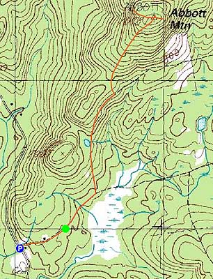
Route: Pitts Road, snowmobile trail, (Abbott Mountain), snowmobile trail, Pitts Road
After having wondered about Abbott Mountain for a few years, I decided to head over and check it out on a Friday afternoon.
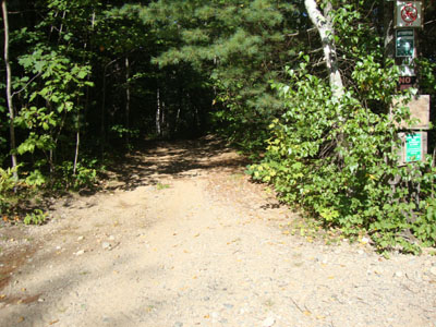
After parking at somewhat of a fork in the road on Owl's Nest Road (which technically continued straight, in a much narrower format), I headed up Pitts Road, continuing straight past the last driveway onto an older woods road. Less than five minutes later, I reached a junction with a snowmobile trail and took a left to head uphill.
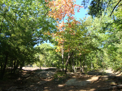
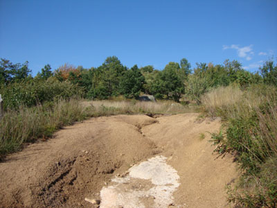
About ten minutes after that, I observed some ledges rising up from the road on the left. I followed those up somewhat steeply (lots of evidence of four wheeler traffic), taking a combination of four wheeler roads (the uphill ones all seemed to connect together eventually near the top) uphill past some early fall foliage to the somewhat open summit. From what appeared to be the highpoint I had excellent views to the south and west. Continuing west on a dirt road of some sort, I soon found myself at some excellent view ledges, which would show the Presidentials on a clear day.
Back at the highpoint, I next headed east and came to some ledges that looked at the Atlantic Ocean.
While first portion of the hike isn't particularly memorable, the summit views sure make up for it.
| Hike Ratings |
|
Getting To Trailhead: |
Moderate |
| Destination: |
Abbott Mountain |
|
Length: |
Moderate |
|
Steepness: |
Moderate |
|
Navigation: |
Moderate |
|
Views: |
Excellent |
|
Crowds: |
Minimal |
|
| Hike Stats |
|
Date Hiked: |
Friday, August 13, 2010 |
| Hike Commenced: |
3:57 PM |
| Parking Elevation: |
590' |
| Destination: |
Abbott Mountain |
| Ascent Commenced: |
4:01 PM |
| Summit Reached: |
4:24 PM |
| Time Elapsed: |
00:23 |
| Trailhead Elevation: |
615' |
| Summit Elevation: |
1,078' |
| Vertical Gain: |
523' |
|
|
| Hike Ended: |
5:09 PM |
| Hike Time Elapsed: |
01:12 |
| Hike Vertical Gain: |
628' |
|

The beginning of the woods road at the end of the private road portion of Pitts Road

Looking up the road near the top of Abbott Mountain

Looking northwest at the Ossipee and Sandwich Ranges from near the summit of Abbott Mountain


Directions to trailhead: Take Route 11 South from North Shapleigh. Take a left onto Jones Road (just before the Post Office). At the end of Jones Road, take a left onto Owl's Nest Road. Continue as the road turns to dirt. Park next to a quasi-fork in the road, then continue on foot uphill to the right onto Pitts Road. Continue straight onto past the last driveway onto the woods road toward Abbott Mountain.
Back to Abbott Mountain Profile
|