Home
States
Colorado
Connecticut
Maine
Massachusetts
New Hampshire
New York
Rhode Island
Utah
Vermont
View All
Lists
NE 4,000 Footers
NE 100 Highest
NH 4,000 Footers
NH 100 Highest
NH 52 With A View
NH Belknap Range
NH Ossipee 10
Links
Trail Conditions
Trip Log
Sunrises
Sunsets
About
|
Wachusett Mountain
Princeton, MA, and Westminster, MA
Trailheads, measurements, times, distances, and maps are all approximate and relative to the hike(s) as shown below.

Balance Rock Trail
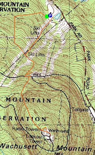
We had pretty bad timing for this hike - just as we began our ascent, a large system of clouds moved over the area, making a previously clear and picturesque day not so clear and picturesque. We started at the ski area base and took a very leisurely stroll up the Balance Rock and Old Indian trails to the summit.
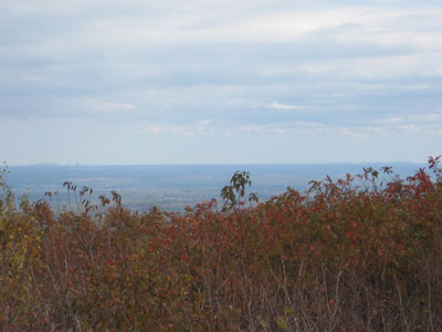
With the exception of one moderately steep section toward the end of the Old Indian Trail, this is a very easy hike. The bare (read paved) summit allows for near 360 degree views.
| Hike Ratings |
|
Getting To Trailhead: |
Easy |
| Destination: |
Wachusett Mountain |
|
Length: |
Easy |
|
Steepness: |
Moderate |
|
Navigation: |
Easy |
|
Views: |
Excellent |
|
Crowds: |
Heavy |
|
| Hike Stats |
|
Date Hiked: |
Sunday, October 15, 2006 |
| Hike Commenced: |
11:39 AM |
| Parking Elevation: |
1,045' |
| Destination: |
Wachusett Mountain |
| Ascent Commenced: |
11:40 AM at Balance Rock Trail trailhead |
| Summit Reached: |
1:22 PM |
| Trailhead Elevation: |
1,045' |
| Summit Elevation: |
2,006' |
| Vertical Gain: |
1,006' |
| Hike Ended: |
2:46 PM |
| Hike Vertical Gain: |
1,056' |
|

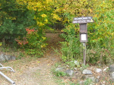
Balance Rock Trail trailhead

Wachusett summit, looking east at Boston (left) and the Blue Hills (right)


Directions to trailhead: Drive up to the top parking lot at the ski area. Trailhead is to the right of the base area complex (to the left of Maintenance).
Back to Wachusett Mountain Profile
|