Home
States
Colorado
Connecticut
Maine
Massachusetts
New Hampshire
New York
Rhode Island
Utah
Vermont
View All
Lists
NE 4,000 Footers
NE 100 Highest
NH 4,000 Footers
NH 100 Highest
NH 52 With A View
NH Belknap Range
NH Ossipee 10
Links
Trail Conditions
Trip Log
Sunrises
Sunsets
About
|
Kibby Mountain
T1 R7, ME
Trailheads, measurements, times, distances, and maps are all approximate and relative to the hike(s) as shown below.

The ATV trail to Kibby Mountain
Route: ATV trail
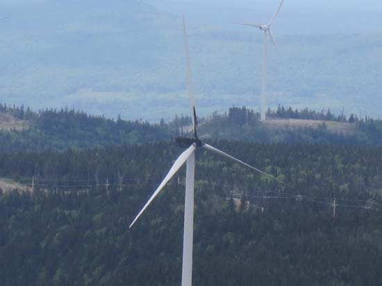
ATV road was generally dry with a few muddy stretches that could generally be avoided. Views in all directions from the summit observation tower. The observation tower is a little wobbly with rotten decking, however the cross beams under it are solid. Pretty interesting to see the wind turbine that caught fire (still charred and not operable).
| Hike Ratings |
|
Getting To Trailhead: |
Moderate |
| Destination: |
Kibby Mountain |
|
Length: |
Moderate |
|
Steepness: |
Moderate |
|
Navigation: |
Easy |
|
Views: |
Excellent |
|
Crowds: |
Minimal |
|
| Hike Stats |
|
Date Hiked: |
Sunday, June 16, 2013 |
| Parking Elevation: |
2,570' |
| Destination: |
Kibby Mountain |
| Time Elapsed: |
00:32 |
| Trailhead Elevation: |
2,570' |
| Summit Elevation: |
3,654' |
| Distance: |
2.6 miles |
| Vertical Gain: |
1,094' |
|
|
| Hike Time Elapsed: |
01:03 |
| Hike Vertical Gain: |
1,104' |
|

The start of the ATV trail to the top of Kibby Mountain

Looking over the windfarm at the Bigelows

A wind turbine that caught fire
Directions to trailhead: Route 27 north from Eustis to Goldbrook Road. Bear left at 3.4 miles. Bear right at 8.5 miles. Road becomes Beaudry Road at 8.6 miles. Take a right at 9 miles onto (unsigned) road, climbing steeply and soon seeing wind turbine straight ahead. At a small clearing, a lesser used road will head left. We parked here and walked that road (increasingly narrow all the way to the summit). Most vehicles should be able to make it to the clearing as of spring 2013.
Back to Kibby Mountain Profile
|