Home
States
Colorado
Connecticut
Maine
Massachusetts
New Hampshire
New York
Rhode Island
Utah
Vermont
View All
Lists
NE 4,000 Footers
NE 100 Highest
NH 4,000 Footers
NH 100 Highest
NH 52 With A View
NH Belknap Range
NH Ossipee 10
Links
Trail Conditions
Trip Log
Sunrises
Sunsets
About
|
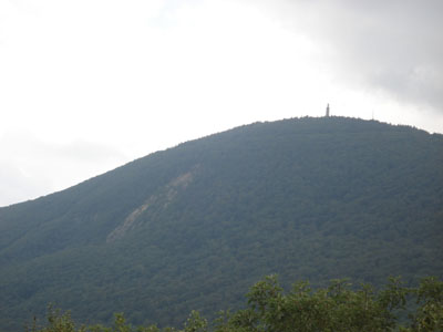
Mt. Greylock
Ragged Mountain
Adams, MA
Trailheads, measurements, times, distances, and maps are all approximate and relative to the hike(s) as shown below.
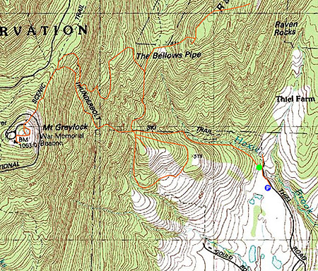
Thunderbolt trail to Mt. Greylock summit
Having never hiked Mt. Greylock, I had been planning on doing a direct ascent for a few weeks when I finally decided to go for it on a sunny July day.
Though the hike started out sunny, the clouds quickly moved in, making for limited views upon arriving at the summit.
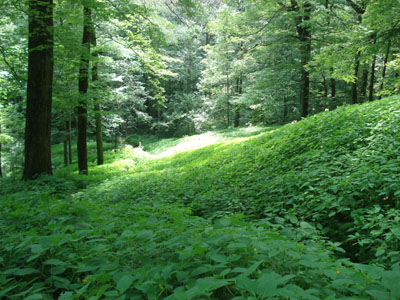
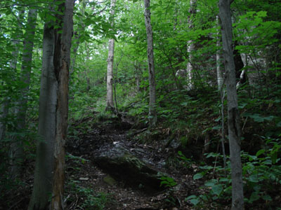
The hike itself, up the Thunderbolt, was extremely challenging - very steep and in some places rather poor footing. Not wanting to have to descend down this thing, I took the Bellows Pipe trail and then meandered around the remnants of the abandoned alpine ski area near the base of the trails, as the rain moved in.
| Hike Ratings |
|
Getting To Trailhead: |
Easy |
| Destination: |
Mt. Greylock |
|
Length: |
Moderate |
|
Steepness: |
Very Difficult |
|
Navigation: |
Easy |
|
Views: |
Excellent |
|
Crowds: |
Moderate to Heavy |
| Destination: |
Ragged Mountain |
|
Length: |
Difficult |
|
Steepness: |
Difficult |
|
Navigation: |
Difficult |
|
Views: |
Moderate |
|
Crowds: |
Minimal |
|
| Hike Stats |
|
Date Hiked: |
Sunday, July 30, 2006 |
| Hike Commenced: |
10:45 AM |
| Parking Elevation: |
1,186' |
| Destination: |
Mt. Greylock |
| Ascent Commenced: |
10:49 AM at Thunderbolt Foot Trail trailhead |
| Summit Reached: |
12:05 PM |
| Time Elapsed: |
01:16 |
| Trailhead Elevation: |
1,215' |
| Summit Elevation: |
3,491' |
| Vertical Gain: |
2,276' |
| Destination: |
Ragged Mountain |
| Ascent Commenced: |
12:43 PM |
| Summit Reached: |
1:45 PM |
| Time Elapsed: |
01:02 |
| Trailhead Elevation: |
3,491' |
| Summit Elevation: |
2,517' |
| Vertical Gain: |
329' |
|
|
| Hike Ended: |
3:48 PM |
| Hike Time Elapsed: |
05:03 |
| Hike Vertical Gain: |
3,023' |
|
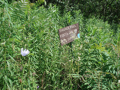
Thunderbolt Foot Trail trailhead (to Mt. Greylock Summit)
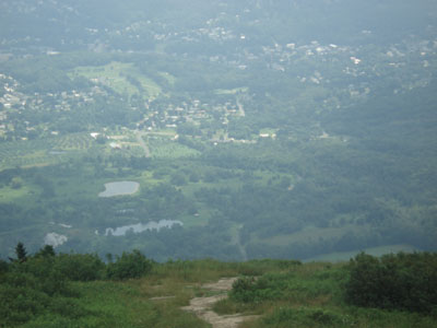
Mt. Greylock summit (looking east-southeast)
Narrow Ragged Mountain trail
South side of Ragged Mountain (looking southwest)

Directions to trailhead: Thiel Road is west of Adams.
Back to Mt. Greylock Profile
Back to Ragged Mountain Profile
|

