Home
States
Colorado
Connecticut
Maine
Massachusetts
New Hampshire
New York
Rhode Island
Utah
Vermont
View All
Lists
NE 4,000 Footers
NE 100 Highest
NH 4,000 Footers
NH 100 Highest
NH 52 With A View
NH Belknap Range
NH Ossipee 10
Links
Trail Conditions
Trip Log
Sunrises
Sunsets
About
|
Pocumtuck Mountain
Colrain, MA, Heath, MA, and Charlemont, MA
Trailheads, measurements, times, distances, and maps are all approximate and relative to the hike(s) as shown below.
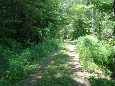
Trail near Pocumtuck Mountain summit
Catamount was once a part of the ever growing metropolis of Colrain, Massachusetts. While somewhat booming in the 1800s and early 1900s, the area died out. Not much remains today other than a memorial to the schoolhouse (first public school in the country to fly the stars and stripes) and some cellarholes. With much of this interesting mountaintop topography being in state forest land, the adventures are abundant.
Pocumtuck Mountain is one of the highest peaks in all of Franklin County. While the view from the cliff is worth the hike, one of the best aspects is how relatively remote the location is - there is no nearby access for cars or nearby houses - rather, there are hundreds of acres of undisturbed forest.
| Hike Ratings |
|
Getting To Trailhead: |
Easy |
| Destination: |
McLeod Pond |
|
Length: |
Moderate |
|
Steepness: |
Moderate |
|
Navigation: |
Difficult |
|
Views: |
Moderate |
|
Crowds: |
Minimal |
| Destination: |
Pocumtuck Mountain |
|
Length: |
Moderate |
|
Steepness: |
Moderate |
|
Navigation: |
Difficult |
|
Views: |
Excellent |
|
Crowds: |
Minimal |
|
| Hike Stats |
|
Date Hiked: |
Sunday, July 9, 2006 |
| Hike Commenced: |
11:56 AM |
| Parking Elevation: |
1165' |
| Destination: |
Catamount - McLeod Pond |
| Ascent Commenced: |
11:59 AM at East Catamount Hill Road trailhead |
| Pond Reached: |
12:34 PM |
| Time Elapsed: |
00:35 |
| Trailhead Elevation: |
1175' |
| Pond Elevation: |
1100' |
| Vertical Gain: |
205' |
| Destination: |
Pocumtuck Mountain |
| Summit Reached: |
1:53 PM |
| Time Elapsed: |
01:19 |
| Summit Elevation: |
1,872' |
| Vertical Gain: |
918' |
|
|
| Hike Ended: |
3:45 PM |
| Hike Time Elapsed: |
03:49 |
| Hike Vertical Gain: |
1,353' |
|
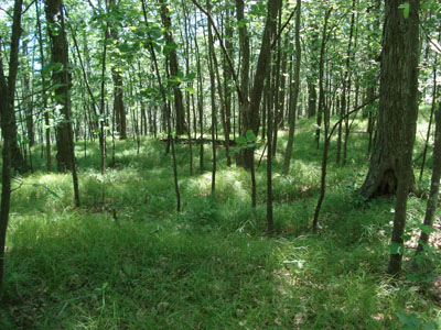
East Catamount Hill Road trailhead
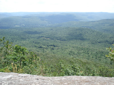
Pocumtuck Mountain summit (south-southwest into the Deerfield River valley)
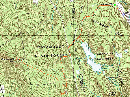

Directions to trailhead: Take Route 112 to Adamsville Road, take a left before the cemetary, bear left and go up the hill until you hit the parking area at the gate.
Back to Pocumtuck Mountain Profile
|

