Home
States
Colorado
Connecticut
Maine
Massachusetts
New Hampshire
New York
Rhode Island
Utah
Vermont
View All
Lists
NE 4,000 Footers
NE 100 Highest
NH 4,000 Footers
NH 100 Highest
NH 52 With A View
NH Belknap Range
NH Ossipee 10
Links
Trail Conditions
Trip Log
Sunrises
Sunsets
About
|
Black Snoot, Mt. Shaw
Moultonborough, NH, Tuftonboro, NH
Trailheads, measurements, times, distances, and maps are all approximate and relative to the hike(s) as shown below.

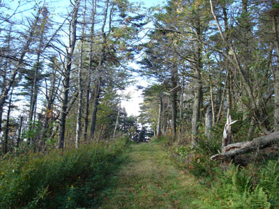
Looking up the Black Snout spur trail
Route: Mt. Shaw Trail, Black Snout Trail, Black Snout Spur Trail, (Black Snoot), Black Snout Trail, (Mt. Shaw), Black Snout Trail, Mt. Shaw Trail
I had been planning to hike Mt. Shaw for over a year. With a halfway decent weather forecast, I decided this would be the day and hit the trail at 2:30.
The trail starts off on an old logging/four wheeling road of sorts, quickly finding its way back to the brook. There is a nice gorge with some small cascades, making for some nice scenery.
The trail is rather hard to follow in places - there are multiple roads that weave in and out and a series of red blazes likely used to mark a property boundary. I tried to go straight wherever possible, trying to stay parallel to the brook.
Soon thereafter, I saw the back of the conservation boundary sign. From here, the trail was easier to follow as blazes started near the brook crossing.
The trail was moderate to easy for a good chunk of time, before becoming steep on its ascent up to the Black Snout Trail. Once on this trail, the grades were easy all the way to the Black Snout spur trail and lookout. I'm not sure why they call this Black Snout (it is labelled as 'Black Snoot' on some historic maps), as there is a Black Snout Mountain on the northern side of the range. The view from here are great - ranging from east to northwest, including great views of the lake.
Returning to the Black Snout Trail, I continued up the easy grades to Mt. Shaw. The views up were were amazing - the whole Sandwich Range, Mt. Washington, Green Mountain, and well into Maine.
After putting around, taking some photos, and chatting with another hiker, it was time to head down - I wanted to get back before dark.
Though not even 3,000 feet in elevation, Mt. Shaw is a nice hike that certainly rivals some 4,000 footers in both views and challenge.
| Hike Ratings |
|
Getting To Trailhead: |
Moderate |
| Destination: |
Black Snoot |
|
Length: |
Moderate |
|
Steepness: |
Difficult |
|
Navigation: |
Difficult |
|
Views: |
Excellent |
|
Crowds: |
Minimal |
| Destination: |
Mt. Shaw |
|
Length: |
Moderate |
|
Steepness: |
Easy |
|
Navigation: |
Easy |
|
Views: |
Excellent |
|
Crowds: |
Minimal |
|
| Hike Stats |
|
Date Hiked: |
Tuesday, October 2, 2007 |
| Hike Commenced: |
2:31 PM |
| Parking Elevation: |
675' |
| Destination: |
Black Snoot |
| Ascent Commenced: |
2:31 PM |
| Summit Reached: |
3:49 PM |
| Time Elapsed: |
01:18 |
| Trailhead Elevation: |
675' |
| Summit Elevation: |
2,803' |
| Distance: |
3.2 miles |
| Vertical Gain: |
2,128' |
| Destination: |
Mt. Shaw |
| Ascent Commenced: |
3:51 PM |
| Summit Reached: |
4:12 PM |
| Time Elapsed: |
00:21 |
| Trailhead Elevation: |
2,803' |
| Summit Elevation: |
2,990' |
| Distance: |
1 mile |
| Vertical Gain: |
285' |
|
|
| Hike Ended: |
5:43 PM |
| Hike Time Elapsed: |
03:12 |
| Hike Distance: |
7.8 miles |
| Hike Vertical Gain: |
2,458' |
|

Mt. Shaw Trail trailhead just off Route 171

Looking east from Black Snoot

Looking up the Black Snow Trail just below Mt. Shaw

Looking north from Mt. Shaw at Mt. Washington


Directions to trailhead: Take 171 southeast from Route 25, past Castle in the Clouds. Shortly after crossing the Tuftonboro town line, there is a bridge/brook crossing. Immediately after this, there is an informal parking lot on the left (maybe 4 cars). The unmarked trail starts at the back of this lot.
Back to Black Snoot Profile
Back to Mt. Shaw Profile
|