Home
States
Colorado
Connecticut
Maine
Massachusetts
New Hampshire
New York
Rhode Island
Utah
Vermont
View All
Lists
NE 4,000 Footers
NE 100 Highest
NH 4,000 Footers
NH 100 Highest
NH 52 With A View
NH Belknap Range
NH Ossipee 10
Links
Trail Conditions
Trip Log
Sunrises
Sunsets
About
|
Carr Mountain
Ellsworth, NH, Rumney, NH, Wentworth, NH, Warren, NH
Trailheads, measurements, times, distances, and maps are all approximate and relative to the hike(s) as shown below.
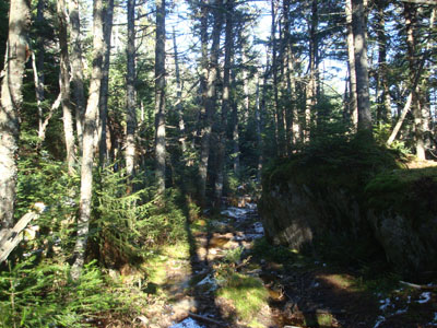
Looking down the Carr Mountain Trail
Route: Three Ponds Trail, Carr Mountain Trail, spur trail (Carr Mountain), spur trail, Carr Mountain Trail, Three Ponds
Carr Mountain had been on my to do list for quite some time. Since I had a weekend day in which I would be having a late start, I finally decided to head over to Carr.
After parking at a half full (half empty?) Three Ponds parking lot, I quickly set foot up the somewhat muddy Three Ponds Trail. While there was a sign for the Carr Mountain Trail a few minutes later, the trail was so vague that it took me an extra blink of the eye to spot it.
The water crossing was slightly tricky, as some rocks were under an inch of water, but doable nonetheless. After that, the trail was gradual to moderate in pitch, and somewhat vague in the open, leafless hardwood forest.
After awhile, there were some evergreen trees and soon, snow and ice. The trail became quite gentle for awhile, before making one last ascent to the ridge. After that, the trail was quite wet - a combination of pooled water and ice. Just past that, the spur trail to the summit was on the left.
The views from the ledgy knobs were decent, though a bit anti-climatic with the treegrowth. Nonetheless, a white Mount Washington was quite stunning in the distance.
Since I made better time than I had planned, I decided to make a fast descent and go for a sunset hike.
All things considered, it was a decent hike. Unfortunately, Carr Mountain seems a bit like another nearby former firetower peak - in need of some clearing.
| Hike Ratings |
|
Getting To Trailhead: |
Easy |
| Destination: |
Carr Mountain |
|
Length: |
Moderate |
|
Steepness: |
Moderate |
|
Navigation: |
Moderate |
|
Views: |
Excellent |
|
Crowds: |
Moderate |
|
| Hike Stats |
|
Date Hiked: |
Sunday, November 2, 2008 |
| Hike Commenced: |
12:04 PM |
| Parking Elevation: |
1,450' |
| Destination: |
Carr Mountain |
| Ascent Commenced: |
12:04 PM |
| Summit Reached: |
1:32 PM |
| Time Elapsed: |
01:28 |
| Trailhead Elevation: |
1,450' |
| Summit Elevation: |
3,453' |
| Distance: |
3.4 miles |
| Vertical Gain: |
2,303' |
|
|
| Hike Ended: |
2:55 PM |
| Hike Time Elapsed: |
02:51 |
| Hike Vertical Gain: |
2,463' |
|

The Three Ponds Trail trailhead

Looking at the Franconia Ridge and Mount Washington from the Carr Mountain summit


Back to Carr Mountain Profile
|


