Home
States
Colorado
Connecticut
Maine
Massachusetts
New Hampshire
New York
Rhode Island
Utah
Vermont
View All
Lists
NE 4,000 Footers
NE 100 Highest
NH 4,000 Footers
NH 100 Highest
NH 52 With A View
NH Belknap Range
NH Ossipee 10
Links
Trail Conditions
Trip Log
Sunrises
Sunsets
About
|
Mount Chocorua
Albany, NH
Trailheads, measurements, times, distances, and maps are all approximate and relative to the hike(s) as shown below.

Looking across the Piper Trail at Mt. Chocorua
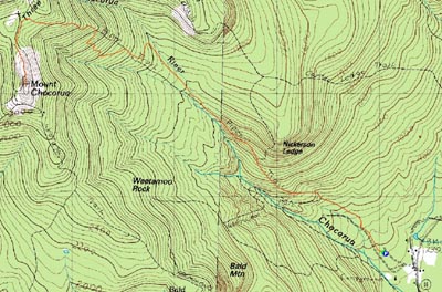
Route: Piper Trail
My original intent was to do something in the 4,000 footer club, however high winds and clouds persuaded me to stay south. As a result, I finally hit the Piper Trail.
I was somewhat surprised to see only a handful of cars in the largest Mt. Chocorua-access parking lot.
The Piper Trail starts off very gradually - there is really not much pitch to speak of until a water crossing almost two miles into the hike. It should also be noted that pretty much every water crossing in excess of 6 inches wide has a bridge over it - I may check this out in the spring when run off is a problem elsewhere!
There was about an inch of snow starting around roughly 2,000 feet.
The ascent after this water crossing is still moderate at best up to the Camp Penacook shelter spur trail. Soon after this, the trail enters some open ledges - and with the ice, not exactly easy going! My Stablicers were barely enough to get up some portions.
I was somewhat troubled to see someone, within the last day or two, had built three or four fires in the middle of the trail. I'm not sure why they did this (the ashes couldn't have been more than half a mile apart), but I guess the bright side is that they apparently put them out when they were done.
Ice wasn't really an issue upon reaching the Champney Falls Trail junction. In fact, once the trail climbed out of the trees, there were only small patches of ice...but the wind! While ascending, I thought I heard air force jets flying around - though I knew that this wasn't likely the case. Nope, no planes in the area...instead, intense wind hitting the big rock.
I almost turned around prior to hitting the subpeak - the wind was absolutely devastating. I ended up dropping pack near the top of the subpeak so that I could cut down my size a bit. Descending down the subpeak, I was literally blown off the ledge onto the flats below (only about 5 feet, but still).
It was very nice to reach the west side of the peak, as there is a small line of trees that helps shield a little bit of wind. I quickly scrambled up, touched the summit, then ducked down between some rocks and took a few photos. Not wanting to risk anything, I quickly headed back to my pack. The winds were so fierce that I had to time the gusts - jog across exposures and hide behind large rocks until the next gust subsided.
I was very happy to be back at the woodline. The descent was somewhat dark, as the sun set behind Chocorua just a little bit after two...not dark enough to need headlamps, as true sunset wasn't for another two hours, but nonetheless not exactly sunny.
Winter is just about here!
| Hike Ratings |
|
Getting To Trailhead: |
Easy |
| Destination: |
Mount Chocorua |
|
Length: |
Moderate |
|
Steepness: |
Difficult |
|
Navigation: |
Easy |
|
Views: |
Excellent |
|
Crowds: |
Minimal |
|
| Hike Stats |
|
Date Hiked: |
Saturday, December 1, 2007 |
| Hike Commenced: |
11:19 AM |
| Parking Elevation: |
780' |
| Destination: |
Mount Chocorua |
| Ascent Commenced: |
11:20 AM |
| Summit Reached: |
1:26 PM |
| Time Elapsed: |
02:06 |
| Trailhead Elevation: |
780' |
| Summit Elevation: |
3,474' |
| Distance: |
4.3 miles |
| Vertical Gain: |
2,824' |
|
|
| Hike Ended: |
3:33 PM |
| Hike Time Elapsed: |
04:14 |
| Hike Distance: |
8.6 miles |
| Hike Vertical Gain: |
2,954' |
|

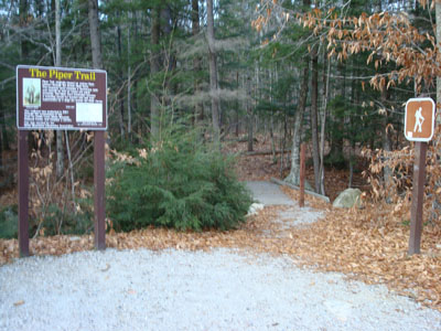
The Piper Trail trailhead

Looking southeast from the Mt. Chocorua summit at Green Mountain


Directions to trailhead: Take Route 16 North from Tamworth. The Piper Trail WMNF sign is on the left, immediately after a general store. The WMNF fee parking area is about a minute or off Route 16. The Piper Trail trailhead is at the back corner of the parking lot.
Back to Mount Chocorua Profile
|