Home
States
Colorado
Connecticut
Maine
Massachusetts
New Hampshire
New York
Rhode Island
Utah
Vermont
View All
Lists
NE 4,000 Footers
NE 100 Highest
NH 4,000 Footers
NH 100 Highest
NH 52 With A View
NH Belknap Range
NH Ossipee 10
Links
Trail Conditions
Trip Log
Sunrises
Sunsets
About
|
Mt. Rowe
Gilford, NH
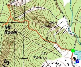
Trailheads, measurements, times, distances, and maps are all approximate and relative to the hike(s) as shown below.

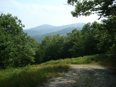
Looking down the access road with Belknap Mountain and Gunstock Mountain in the background
Route: Access road, (Mt. Rowe), unknown trail, (Alpine Ridge summit area), access road.
With a busy weekend and a not-so-great weather forecast, I knew my hiking opportunities were minimal at best. Nonetheless, I was able to sneak out on a very hazy Sunday afternoon for a quick hike up Mt. Rowe.
Arriving at the Gunstock ski area base area, I could see that the visibility was not good at all due to the haze (93 degree temperature). I had previously hiked Mt. Rowe nearly three years earlier, so I was eager to try it again and spend some time looking for the summit of the old Alpine Ridge ski area.
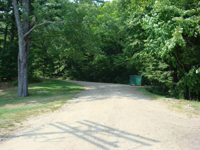
The access road departs from near the skateboard/biking park near the base lodge. Being that it mainly follows an old ski trail, the grade is consistent as it climbs the mountain. Though it has not been part of the ski area for years, this old trail is still fairly wide and open, thus allowing views for most of the ascent.
The actual summit is wooded - it's a bit beyond the summit towers and old chairlift footings. After walking around the summit area for a few minutes (looking for any other remnants, as well as possible connector trails to the old Alpine Ridge ski area), I descended down a short trail just above the access road. Despite the haze, I was amazed with this view (I do not recall looking out from here three years ago), as it looks straight out at the lake. The haze gave it sort of a surreal feeling, as there was a hazy backdrop to the sailboats blocking the mountains and houses.
Just below this viewpoint, I found the narrow access trail to Alpine Ridge. Poking around a communication tower, I found the footings from the old double chairlift (the footings are just downhill from this tower, along the ridge). Despite the chairlift being on a once wide open slope, there isn't much to see anymore - it's amazing what a decade and a half can do for forest recovery!
The short ascent, then descent to Gunstock was pretty easy. I was fortunate to take such a short hike, as a tremendously powerful thunderstorm moved in just a few hours later.
| Hike Ratings |
|
Getting To Trailhead: |
Easy |
| Destination: |
Mt. Rowe |
|
Length: |
Easy |
|
Steepness: |
Moderate |
|
Navigation: |
Easy |
|
Views: |
Excellent |
|
Crowds: |
Minimal |
|
| Hike Stats |
|
Date Hiked: |
Saturday, August 25, 2007 |
| Hike Commenced: |
2:14 PM |
| Parking Elevation: |
935' |
| Destination: |
Mt. Rowe |
| Ascent Commenced: |
2:16 PM |
| Summit Reached: |
2:37 PM |
| Time Elapsed: |
00:21 |
| Trailhead Elevation: |
935' |
| Summit Elevation: |
1,680' |
| Vertical Gain: |
745' |
|
|
| Hike Ended: |
3:23 PM |
| Hike Time Elapsed: |
01:09 |
| Hike Vertical Gain: |
820' |
|

The beginning of the access road near the Gunstock base area

Looking north-northeast from near the summit of Mt. Rowe


Directions to trailhead: Take Route 11A to Gunstock entrance, parking lot near the base lodge of the ski area. Trailhead is on the other side of the base lodge, near the skateboard park.
Back to Mt. Rowe Profile
|