Home
States
Colorado
Connecticut
Maine
Massachusetts
New Hampshire
New York
Rhode Island
Utah
Vermont
View All
Lists
NE 4,000 Footers
NE 100 Highest
NH 4,000 Footers
NH 100 Highest
NH 52 With A View
NH Belknap Range
NH Ossipee 10
Links
Trail Conditions
Trip Log
Sunrises
Sunsets
About
|
Mt. Tecumseh
Waterville Valley, NH
Trailheads, measurements, times, distances, and maps are all approximate and relative to the hike(s) as shown below.

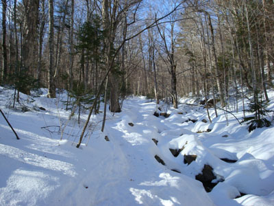
Looking up the Mt. Tecumseh Trail
Route: Mt. Tecumseh Trail, Sosman Trail, (summit), Sosman Trail, Mt. Tecumseh Trail, The Boneyard, Lower Periphery
Originally, I was hoping to do a Presidential peak, however the clouds didn't seem to want to move out fast enough for my liking. Option B was Mt. Tecumseh.
Though there were a lot of cars lined up for the ski area, there were plenty of spaces near the Mt. Tecumseh Trail trailhead. After strapping on my snowshoes, I was off. The second and third brook crossings still had snowbridges over them, despite the recent rain and warmer weather.
The first portion of the Mt. Tecumseh Trail is easy to moderate going. After it drops down to the third brook crossing, thigns steep up a bit and stay moderately steep for some time. Just before the ridge, the trail gets just about its steepest. This was my first time using snowshoes with a riser bar - it felt like cheating! The trail was mostly frozen granular, so snowshoes weren't even needed.
Once the ridge and the Sosman Trail are reached, things are gradual for awhile, up to the split in the trail. From here, the Sosman Trail (the left option) was broken out - it starts of gradually before steepening up a bit just below the summit.
The views from the top were great - the Tripyramids view was much better this time than on the somewhat hazy day I last ascended this peak some 7 months earlier.
I barebooted the descent to the "Outlook" spur trail, which leads to the Boneyard ski trail. From here, I put on my snowshoes and headed down through the ski area base area and to the parking lot.
| Hike Ratings |
|
Getting To Trailhead: |
Easy |
| Destination: |
Mt. Tecumseh |
|
Length: |
Moderate |
|
Steepness: |
Difficult |
|
Navigation: |
Easy |
|
Views: |
Excellent |
|
Crowds: |
Minimal |
|
| Hike Stats |
|
Date Hiked: |
Tuesday, December 25, 2007 |
| Hike Commenced: |
11:52 AM |
| Parking Elevation: |
1,840' |
| Destination: |
Mt. Tecumseh |
| Ascent Commenced: |
11:59 AM |
| Summit Reached: |
1:30 PM |
| Time Elapsed: |
01:31 |
| Trailhead Elevation: |
1,845' |
| Summit Elevation: |
4,003' |
| Distance: |
2.5 miles |
| Vertical Gain: |
2,273' |
|
|
| Hike Ended: |
3:16 PM |
| Hike Time Elapsed: |
03:24 |
| Hike Vertical Gain: |
2,298' |
|

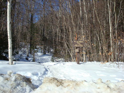
Mt. Tecumseh Trail trailhead next to the top Waterville Valley Ski Area parking lot

Looking east at Mt. Tripyramid from the Mt. Tecumseh summit


Directions to trailhead: Take Route 49 into Waterville Valley. Follow signs to the alpine ski area. Trailhead and parking are at the top parking lot.
Back to Mt. Tecumseh Profile
|