Home
States
Colorado
Connecticut
Maine
Massachusetts
New Hampshire
New York
Rhode Island
Utah
Vermont
View All
Lists
NE 4,000 Footers
NE 100 Highest
NH 4,000 Footers
NH 100 Highest
NH 52 With A View
NH Belknap Range
NH Ossipee 10
Links
Trail Conditions
Trip Log
Sunrises
Sunsets
About
|
Mt. Tecumseh
Waterville Valley, NH
Trailheads, measurements, times, distances, and maps are all approximate and relative to the hike(s) as shown below.

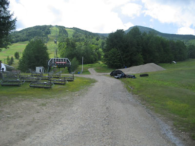
Looking up the Lower Periphery ski trail with the summit in the background
Route: Lower Periphery, The Boneyard, Mt. Tecumseh Trail, Sosman Trail, (summit), Sosman Trail, Mt. Tecumseh Trail, The Boneyard, Lower Periphery
After having to abort my hike to Mt. Tecumseh over the weekend due to thunder, I decided I'd try and get out and go for it again - though this time via the ski area, so that I could get a decent workout during the seemingly endless stretch of rain.
Arriving at the parking lot, I was a bit surprised to see some blue sky. As I ascended the ski trails, and dipped into the woods onto the Mt. Tecumseh Trail at the view point, the clouds took over. Perhaps from the humidity and warmer temperatures, I was getting a decent work out on the long, straight stretch of the Mt. Tecumseh Trail before it cleared the ridge.
At the summit the views were decent despite the clouds. Surprisingly I could see points beyond the Tripyramids - not bad, considering the Sandwich Dome and other peaks near it were in the clouds.
Since the weather and all too well known trail made the hike a bit monotonous, I decided to crank up the MP3 player, listening to the Wallflowers' Breach and Jim O'Rourke's Bad Timing.
| Hike Ratings |
|
Getting To Trailhead: |
Easy |
| Destination: |
Mt. Tecumseh |
|
Length: |
Moderate |
|
Steepness: |
Difficult |
|
Navigation: |
Easy |
|
Views: |
Excellent |
|
Crowds: |
Minimal |
|
| Hike Stats |
|
Date Hiked: |
Tuesday, July 22, 2008 |
| Hike Commenced: |
2:13 PM |
| Parking Elevation: |
1,840' |
| Destination: |
Mt. Tecumseh |
| Ascent Commenced: |
2:16 PM |
| Summit Reached: |
3:23 PM |
| Time Elapsed: |
01:07 |
| Trailhead Elevation: |
1,870' |
| Summit Elevation: |
4,003' |
| Vertical Gain: |
2,143' |
|
|
| Hike Ended: |
4:47 PM |
| Hike Time Elapsed: |
02:34 |
| Hike Vertical Gain: |
2,183' |
|

The bottom of the Lower Periphery ski trail

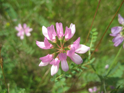
Crown-Vetch growing on Lower Periphery

Looking east at Mt. Tripyramid from the Mt. Tecumseh summit


Directions to trailhead: Take Route 49 into Waterville Valley. Follow signs to the alpine ski area. Trailhead and parking are at the top parking lot.
Back to Mt. Tecumseh Profile
|