Home
States
Colorado
Connecticut
Maine
Massachusetts
New Hampshire
New York
Rhode Island
Utah
Vermont
View All
Lists
NE 4,000 Footers
NE 100 Highest
NH 4,000 Footers
NH 100 Highest
NH 52 With A View
NH Belknap Range
NH Ossipee 10
Links
Trail Conditions
Trip Log
Sunrises
Sunsets
About
|
Mt. Tecumseh
Waterville Valley, NH
Trailheads, measurements, times, distances, and maps are all approximate and relative to the hike(s) as shown below.

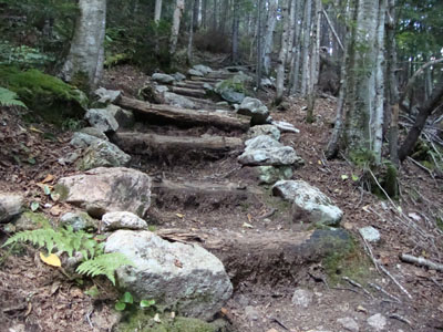
The Mt. Tecumseh Trail prior to the last water crossing
Route: Mt. Tecumseh Trail
Though I was tempted to do something more scenic, I opted to hike Mt. Tecumseh via the Tecumseh Trail. This proved to be a worthy decision, as it started to rain about halfway up. For the first time, I hiked to the peak and back via the Tecumseh Trail proper (ski area side) - including the two parts of the trail I almost always bypass - the very bottom and very top. Not liking the pointless ups and downs and patches of poor footing, I won't be rushing back to do these again anytime soon.
There were surprisingly quite a few blowdowns on the trail, considering its popularity. I ended up removing about half a dozen.
| Hike Ratings |
|
Getting To Trailhead: |
Easy |
| Destination: |
Mt. Tecumseh |
|
Length: |
Moderate |
|
Steepness: |
Difficult |
|
Navigation: |
Easy |
|
Views: |
Excellent |
|
Crowds: |
Moderate |
|
| Hike Stats |
|
Date Hiked: |
Wednesday, August 19, 2009 |
| Hike Commenced: |
3:41 PM |
| Parking Elevation: |
1,840' |
| Destination: |
Mt. Tecumseh |
| Ascent Commenced: |
3:42 PM |
| Summit Reached: |
4:49 PM |
| Time Elapsed: |
01:07 |
| Trailhead Elevation: |
1,845' |
| Summit Elevation: |
4,003' |
| Vertical Gain: |
2,293' |
|
|
| Hike Ended: |
6:45 PM |
| Hike Time Elapsed: |
03:04 |
| Hike Vertical Gain: |
2,433' |
|

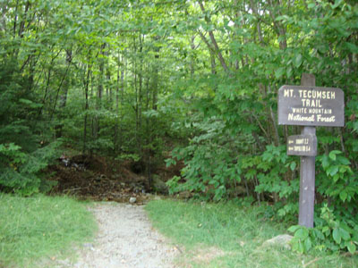
The Mt. Tecumseh Trail trailhead near parking lot 1

A bear near the lower Mt. Tecumseh Trail - only the second bear I've ever seen on an NH 4K hike

Looking at the Tripyramids, Passaconaway, the Sleepers, and Whiteface from the Mt. Tecumseh summit vista


Back to Mt. Tecumseh Profile
|