Home
States
Colorado
Connecticut
Maine
Massachusetts
New Hampshire
New York
Rhode Island
Utah
Vermont
View All
Lists
NE 4,000 Footers
NE 100 Highest
NH 4,000 Footers
NH 100 Highest
NH 52 With A View
NH Belknap Range
NH Ossipee 10
Links
Trail Conditions
Trip Log
Sunrises
Sunsets
About
|
Ragged Mountain
Danbury, NH
Trailheads, measurements, times, distances, and maps are all approximate and relative to the hike(s) as shown below.

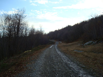
Heading up the Sunnyside ski trail
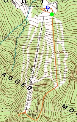
Route: Route: Liftline, Sunnyside, (Ragged Mountain), unknown trail, Sunnyside, Liftline
I've skied Ragged Mountain once to date - spring 2002. I enjoyed the skiing and especially the scenery. Thus, I've been wanting to hike or ski it for quite some time.
I arrived at a base base area around 4:30 - the mountain is under new ownership and they're definitely busy getting some improvements completed in time for the approaching ski season.
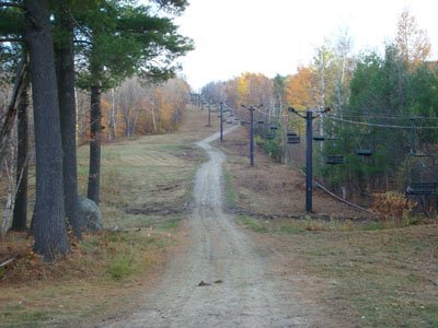
While I had wanted to hike this mountain via one of the hiking trails on the west or south side, there was not enough time. Thus, I decided to take a moderate pitched ascent - following a work road first up a double chairlift lift line, then up a novice trail. The views from these trails were great - Cardigan to my back, and the side of Kearsarge in front of me as I approached the summit.
The true summit (marked with a cairn) is just in the woods between the ski patrol hut, tower, and top chairlift terminal. The views from the top of the chairlift are great - Cardigan in plain sight and on a clearer day, the western White Mountains. Near the communications tower is a nice ledge view looking to the southwest.
After looking around the summit for a little bit, I headed back down via the same route (I would have considered going down some of the other ski trails, however I could it was still a bit soggy from the recent rains).
| Hike Ratings |
|
Getting To Trailhead: |
Easy |
| Destination: |
Ragged Mountain |
|
Length: |
Moderate |
|
Steepness: |
Moderate |
|
Navigation: |
Easy |
|
Views: |
Excellent |
|
Crowds: |
Minimal |
|
| Hike Stats |
|
Date Hiked: |
Wednesday, October 31, 2007 |
| Hike Commenced: |
4:29 PM |
| Parking Elevation: |
1,120' |
| Destination: |
Ragged Mountain |
| Ascent Commenced: |
4:33 PM |
| Summit Reached: |
5:04 PM |
| Time Elapsed: |
00:31 |
| Trailhead Elevation: |
1,130' |
| Summit Elevation: |
2,225' |
| Vertical Gain: |
1,095' |
|
|
| Hike Ended: |
5:41 PM |
| Hike Time Elapsed: |
01:12 |
| Hike Vertical Gain: |
1,155' |
|

Looking up the Liftline ski trail from the base of the ski area

Looking northwest at Mt. Cardigan from near the Ragged Mountain summit


Directions to trailhead: Take Route 104 West from I-93. Once in Danbury, take a left onto Ragged Mountain Road. Continue a few miles up this road, past the golf course. There are multiple parking lots near the base lodge.
Back to Ragged Mountain Profile
|