Home
States
Colorado
Connecticut
Maine
Massachusetts
New Hampshire
New York
Rhode Island
Utah
Vermont
View All
Lists
NE 4,000 Footers
NE 100 Highest
NH 4,000 Footers
NH 100 Highest
NH 52 With A View
NH Belknap Range
NH Ossipee 10
Links
Trail Conditions
Trip Log
Sunrises
Sunsets
About
|
Mount Mansfield
Adam's Apple, The Chin, The Nose, The Forehead
Stowe, VT, and Underhill, VT
Trailheads, measurements, times, distances, and maps are all approximate and relative to the hike(s) as shown below. "Summit" photos may in fact not be at the actual summit - but instead at the best nearby vista.

Heading south from the Chin to eventually the Forehead
Mt. Mansfield (the Chin) is the highest point in Vermont. The Long Trail is fairly well maintained throughout this area, with waterbars and stairs built into places that would otherwise be disasters - as seen on other parts of the trail south of here.
The hike becomes extreme on the last part of the ascent up to the Chin - there is somewhat sustained climbing up the north face - not fun when it's icy! From the Chin to points to the south is not overly challenging. Much of the hike is above the treeline, making for some windy but scenic hiking.
| Hike Ratings |
|
Getting To Trailhead: |
Easy |
| Destination: |
Adam's Apple |
|
Length: |
Moderate |
|
Steepness: |
Difficult |
|
Navigation: |
Easy |
|
Views: |
Excellent |
|
Crowds: |
Minimal |
| Destination: |
The Chin |
|
Length: |
Difficult |
|
Steepness: |
Very Difficult |
|
Navigation: |
Moderate |
|
Views: |
Excellent |
|
Crowds: |
Minimal |
| Destination: |
The Forehead |
|
Length: |
Difficult |
|
Steepness: |
Moderate |
|
Navigation: |
Easy |
|
Views: |
Excellent |
|
Crowds: |
Heavy |
| Destination: |
The Nose |
|
Length: |
Difficult |
|
Steepness: |
Easy |
|
Navigation: |
Moderate |
|
Views: |
Excellent |
|
Crowds: |
Heavy |
|
| Hike Stats |
|
Date Hiked: |
Thursday, September 21, 2006 |
| Hike Commenced: |
9:01 AM |
| Parking Elevation: |
1,560' |
| Destination: |
Adam's Apple |
| Ascent Commenced: |
9:02 AM at Long Trail trailhead |
| Summit Reached: |
10:27 AM |
| Trailhead Elevation: |
1,620' |
| Summit Elevation: |
4,120' |
| Vertical Gain: |
2,525' |
| Destination: |
The Chin |
| Ascent Commenced: |
10:31 AM |
| Summit Reached: |
10:46 AM |
| Trailhead Elevation: |
4,120' |
| Summit Elevation: |
4,393' |
| Vertical Gain: |
353' |
| Destination: |
The Forehead |
| Ascent Commenced: |
10:50 AM |
| Summit Reached: |
11:58 AM |
| Trailhead Elevation: |
4,393' |
| Summit Elevation: |
3,940' |
| Vertical Gain: |
380' |
| Destination: |
The Nose (non radiated high point) |
| Ascent Commenced: |
12:01 PM |
| Summit Reached: |
12:16 PM |
| Trailhead Elevation: |
3,940' |
| Summit Elevation: |
4,025' |
| Vertical Gain: |
185' |
| Hike Ended: |
2:10 PM |
| Hike Vertical Gain: |
3,633' |
|
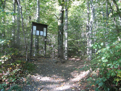
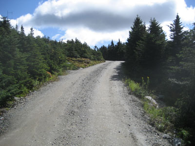
Long Trail trailhead on Route 108
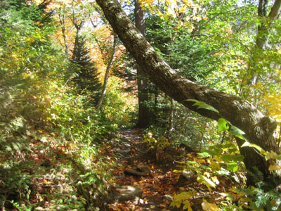
Long Trail up to Adam's Apple. I hit my head on that tree.
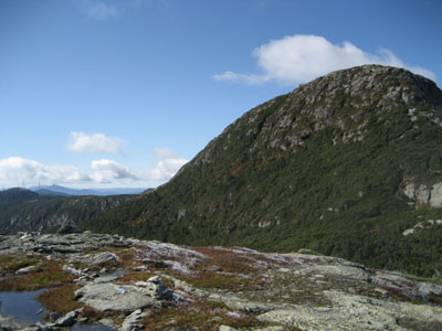
Adam's Apple Summit, looking south at the Chin
Heading south from Adam's Apple to the Chin

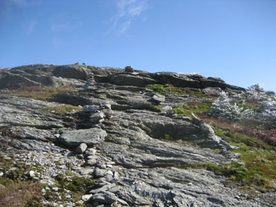
Long Trail up the north face of the Chin - not straight off the edge, but up the cliff to the left
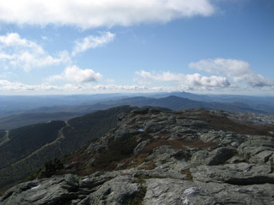
Chin Summit looking south
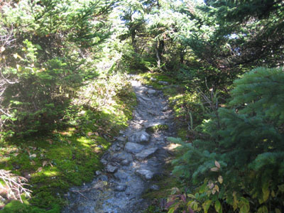
Long Trail to the Forehead
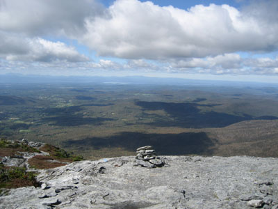
Looking west from the Forehead
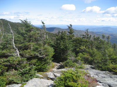
Heading back North on the Long Trail to the Nose
Dirt road around the radiated area of the Nose
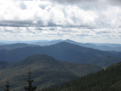
Looking south at Camel's Hump from the Nose
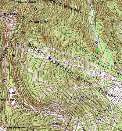

Directions to trailhead: Take 108 North from the Stowe base area, past the small state park visitors kiosk. There will be some parking on the left side of the road, just north of the trailhead. There's additional parking north of there at the picnic area.
Back to The Chin/Mt. Mansfield profile
Back to The Adam's Apple profile
Back to The Nose profile
Back to The Forehead profile
|


